Melbourne Airport (MEL)
Driving Directions / Travel by Car
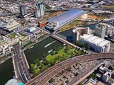
(Melbourne, VIC, Australia)
An important part of the northern Melbourne suburbs, Melbourne Airport (MEL) can be reached from all directions. The airport is especially close to Craigieburn and Bulla to the north, Broadmeadows and Fawkner to the east, Essendon, St. Albans and Avondale Heights to the south, and both Taylors Lakes and Sydenham to the west.
Important roads in the region surrounding Melbourne Airport, from the south and moving in an anti-clockwise direction, include Old Calder Highway, Calder Freeway, Bulla Diggers Rest Road, Sunbury Road, Somerton Road, Barry Road, Melrose Drive, the Western Ring Road, Sharps Road and Keilor Road.
A number of notable attractions lie close to Melbourne Airport and include the Gallibrand Hill Park and Greenvale Reservoir to the north-east, and both Keilor Park and Brimbank Park to the south.
Within the complex of Melbourne Airport itself, Grants Road leads onto Melrose Drive, while Arrival Drive, Melbourne Drive and Airport Drive all lead to the Tullamarine Freeway, in a south-easterly direction.
Your particular destination within Melbourne Airport may affect the direction in which you arrive.
Directions to Melbourne Airport (MEL) from Melbourne city centre:
- Melbourne Airport is situated 22 km / 14 miles from the city centre
- The airport can be reached in less than 30 minutes when travelling by car
- Melbourne Airport has good connections to the main highway network and the Tullamarine Freeway links directly to the airport
- When travelling to Melbourne Airport during rush hours, be sure to allow extra time for possible traffic delays
Melbourne Airport (MEL): Virtual Google Maps
